


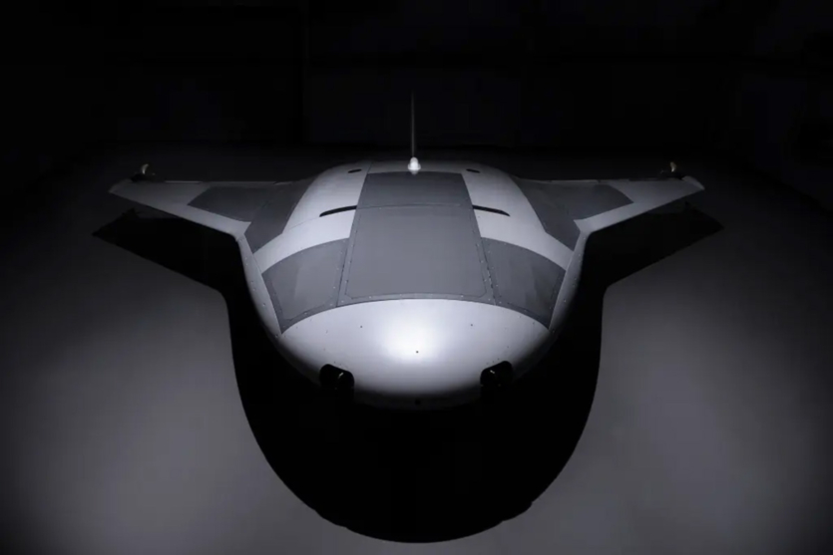
A top-secret prototype of a US military unmanned submarine called Manta Ray has been spotted by Google Maps users and remains available for viewing. Satellite photos showing a ship resembling a fantastic starship are moored at the Port Hueneme naval base in California, its futuristic forms are hard to miss at the location.
The autonomous vessel was named after a marine creature due to its similar shapes and the ability to remain deep underwater, operating in low power mode. Manta Ray, created by Northrop Grumman as part of the US Navy's project to develop long-range underwater weapons, is a complex underwater drone capable of staying in sleep mode on the ocean floor for an extremely long time without refueling. It uses "effective gliding" underwater.
"Our successful full-scale test of Manta Ray confirms the vehicle's readiness to operate in real conditions. ... The ship is designed with multiple compartments for payloads of various sizes and types, allowing it to perform various naval missions," wrote Dr. Kyle Werner, program manager of Manta Ray at DARPA, in a press release.
The modular design allows Manta Ray to be disassembled and transported in standard containers, without the need for additional port facilities. The US Navy tested the ship off the coast of Southern California for over three months. Analysts suspect that the Navy's efforts in developing underwater drones are aimed at strategically countering the submarine operations of Russia and China.
Source: New York Post


Comments (0)
There are no comments for now